Public Works
Fire, Rain & Potential Impacts

Fires in the fall of 2012 significantly impacted the landscape of areas in Chelan County and have increased the risk of flooding and mud flows to lands downstream of the burned areas. Until vegetation in these areas recovers, little can be done to prevent excess water, debris and mud flows from coming down and causing potential damage to properties downstream.
Click here to go to the "After the Fires" webpage for more information regarding the fire recovery effort.
Chelan County Public Works Department, in cooperation with the county’s Natural Resource Department, the U.S. Forest Service (USFS), the United States Geologic Service (USGS), Natural Resource Conservation Service (NRCS) and Cascadia Conservation District have purchased and installed a series of rain gages. Selection of rain gage locations was based upon numerous factors, including but not limited to historic flooding, high burn severity areas and population centers.
Why rain gages?
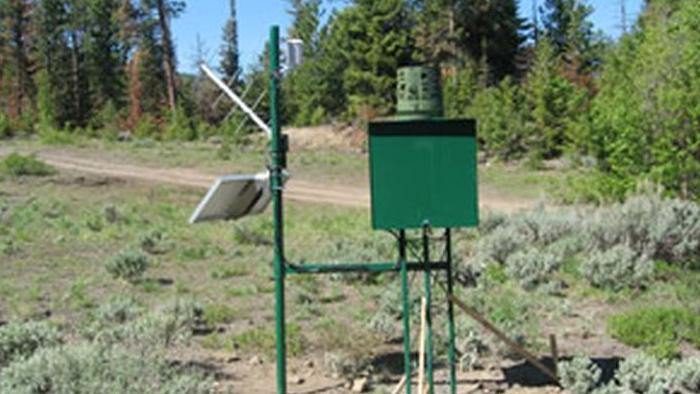
Rain gages are instruments that measure precipitation using a mechanism to collect the precipitation. The purpose of these rain gages is to provide an early alert system to the community when a potentially high intensity storm is in the area.
Wenatchee Complex rain gage locations.
Entiat & Chelan Ranger District rain gage locations.
How will the rain data be used?
When a rain event occurs, data from each gage will be transmitted via satellite on an hourly basis to a USGS database where the National Weather Service will be observing. During that time, if the predetermined precipitation threshold is reached, then data will be transmitted in shorter intervals in order to monitor the data more closely. Based upon the data received, the National Weather Service may issue weather warnings, advisories, and/or watches.
Click below for information on precipitation data:
- Chelan County rain gages (USGS)
- Washington State rain gages (USGS)
- Map of rain gage locations in Chelan County (MesoWest)
- Precipitation monitor information for Washington State counties (MesoWest)
- Weather Conditions Data for Dinkleman Canyon (NOAA)
- Weather Conditions Data for Spencer Canyon (NOAA)
What can I do?
By obtaining a NOAA weather radio, you are able to receive complete and continuous weather information directly from the National Weather Service. This includes severe and hazardous weather warnings, watches, and potential flooding information. A NOAA weather radio can be purchased at any electronic store or online. Below is more information regarding NOAA's weather radio program:
- NOAA Weather Radio Webpage
- NOAA Weather Radio Spokane Station WXL-86
- NOAA Weather Radio Informational Flyer
NOAA terms & definitions of interest:
| Advisory | (Abbrev. ADVY)- Highlights special weather conditions that are less serious than a warning. They are for events that may cause significant inconvenience, and if caution is not exercised, it could lead to situations that may threaten life and/or property. |
| Watch | A watch is used when the risk of a hazardous weather or hydrologic event has increased significantly, but its occurrence, location, and/or timing is still uncertain. It is intended to provide enough lead time so that those who need to set their plans in motion can do so. |
| Warning | A warning is issued when a hazardous weather or hydrologic event is occurring, is imminent, or has a very high probability of occurring. A warning is used for conditions posing a threat to life or property. |
Click here for latest advisories, watches or warnings for North Central Washington.
NOAA flood terms & definitions of interest:
| Flash Flood | A rapid and extreme flow of high water into a normally dry area, or a rapid water level rise in a stream or creek above a predetermined flood level, beginning within six hours of the causative event (e.g., intense rainfall, dam failure, ice jam). However, the actual time threshold may vary in different parts of the country. Ongoing flooding can intensify to flash flooding in cases where intense rainfall results in a rapid surge of rising flood waters. |
| Flash Flood Statement | (FFS) In hydrologic terms, a statement by the NWS which provides follow-up information on flash flood watches and warnings. |
| Flash Flood Warning | Issued to inform the public, emergency management, and other cooperating agencies that flash flooding is in progress, imminent, or highly likely. |
| Flash Flood Watch |
Issued to indicate current or developing hydrologic conditions that are favorable for flash flooding in and close to the watch area, but the occurrence is neither certain or imminent.
|
Click here for the complete National Weather Service Glossary.
Related Information
- Central Washington Fire Recovery is an informative website that provides additional resources regarding the Wenatchee Complex Fire. It provides Burned Area Emergency Response updates, frequently asked questions, maps, and other useful information.
- After the Fires is Chelan County's webpage containing additional information for Chelan County residents.
- National Weather Service- Wenatchee Complex Fires Support Page provides more useful information regarding the threat of flash floods post-Wenatchee Complex Fires.
Posted: 10/27/2014 01:22 PM
Last Updated: 10/17/2016 04:57 PM